Recreation Permits: Camping and Hiking in the Mission Mountain Tribal Wilderness:
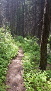 The Mission Mountains Tribal Wilderness is located on the western slopes of the Mission Range. The area covers approximately 91,778 acres. It is roughly 34 miles long and five miles wide. Elevations range from four thousand to nearly ten thousand feet.
All recreational activities on Tribal owned lands require a non-member person over the age of 11 to purchase a Tribal Conservation Permit. All non-members must have on their person; whenever engaged in recreation activities on Tribally owned lands of the Reservation, a valid Flathead Reservation Use Permit, and any additional bird, fishing, or camping stamps as required. Certain Tribal campgrounds and recreation areas may have special regulations, which are posted, on site.
NOTE: Recreation Permits must be purchased in person initially from a retail outlet/Reservation Permit vendor to register. After that first registration you can purchase online. Reservation Permits are available on the internet at http://app.mt.gov/Als/Index
Pablo, MT at Zimmer Tackle
Plains, MT at Plains Service Center
Polson, MT at – CSKT, DFWRC, 406 6th Avenue East and Wal-Mart
Ronan, MT at Westland Seed
St. Ignatius, MT at Allard’s Stage Stop
The Go Hike with Mike trail guide contains most every trail head in the Flathead and Kootenai Forest as well as the Mission Mountain Tribal Wilderness. Click here to purchase your copy.
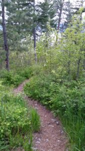 There are many quality hiking very close to Montana’s Flathead Lake. The views from these hikes around Flathead Lake are both beautiful and vast. Hiking is a great way to explore the area while experiencing nature and wildlife. We have created a list of trails you may enjoy. The list of trails when hiking Flathead Lake can be found below.
