The Bison Range, formerly known as the National Bison Range, was established in 1908 by the U.S. Federal Government in the middle of our treaty-reserved home, the Flathead Indian Reservation. The bison living on the Bison Range also are descendants of the free-ranging Reservation herd started by Tribal members in the 1800’s when plains bison were near extinction.
Through Public Law 116-260, Congress restored the Bison Range as a federal trust ownership under the Confederated Salish and Kootenai Tribes (CSKT).
The Tribal Council has adopted, as its interim Bison Range management plan, the current Comprehensive Conservation Plan that was developed and adopted by the U.S. Fish & Wildlife Service (FWS) in 2019 (for which CSKT was a cooperating agency).
As of 2022, the Bison Range is fully owned and managed by CSKT Natural Resource Department.
Some More History of the Bison Range
The National Bison Range was established in 1908 and is one of the oldest Wildlife Refuges in the nation. The Range is about 25 miles south of Montana’s Flathead Lake.
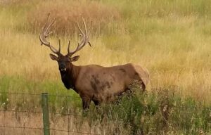
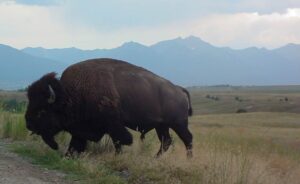 A large portion of the 18, 500 acre Range consists of native Palouse prairie; forests, wetlands, and streams are also found here providing a wide range of habitats for wildlife. Elk, deer, pronghorn, black bear, coyote and ground squirrels are just some of the mammals that share the area with 350 to 500 bison. Over 200 species of birds also call this home including eagles, hawks, meadowlarks, bluebirds, ducks, and geese.
General Information
Fees are charged during the summer (mid-May to late October). The Range is part of the U.S. Fee System and accepts Golden Passes and Federal Waterfowl Stamps. Pay fees at the Visitor Center.
The Range is closed at night. Check the Contact Us page for current hours.
Camping is not allowed on the Range.
Visitor Center
The best place to start your visit is at the Visitor Center. Here you will find informative displays and handouts, restrooms, videos, a bookstore, and staff to answer your questions. Pay entrance fees here. For more information about the Bison Range and other activities in northwest Montana, consider purchasing a copy of the Flathead Lake Vacation Guide.
Auto Tours
 Prairie Drive/West Loop: a 5-mile gravel road that travels through the flats. It is open to trailers and large RVs. It goes by the Bison Display Pasture. Plan for 1/2 hour. Open year round.
Red Sleep Mountain Drive: a 19-mile, one-way, gravel road which gains 2,000feet. There are many switchbacks and 10% grades along the drive. No trailers or vehicles over 32 feet are allowed on this drive. Allow 1 1/2 to 2 hours. Open mid-May to late October. (Check the Contact Us page for current information.)
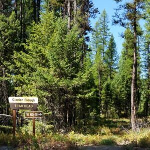
Walking Trails: Hiking is limited on the Range to a few short walking trails. A mile-long Nature Trail is located at the Picnic Area and 1/4-mile Grassland Trail is at the Visitor Center. The 1/2-mile Bitterroot Trail and 1-mile High Point trail are both located off the Red Sleep Mountain Drive. Walking away from your vehicle is prohibited except for these designated trails. For a complete listing of trails around Flathead Lake, see the Go Hike With Mike Trail guide.
Picnic Area
The Range has a picnic area near Mission Creek. There are tables, grills, water, and accessible toilets. A covered pavilion is available on a first-come, first-served basis. There are no garbage cans, so please pack out all trash.
How to get here:
From Missoula: Travel north on US Highway 93 to Ravalli, turn left(to the west) on to State Highway 200, travel approximately 5 miles to the junction of Highways 200 and 212, turn right(to the north) and travel approximately 5 miles to the entrance of the Range at Moiese.
From Kalispell: Travel south on US Highway 93 or State Highway 35 to Polson, then travel Highway 93 through Pablo and Ronan to the junction of Highway 93 and State Highway 212, travel 12 miles (through Charlo) to the entrance of the Range at Moiese.
From the west: Travel Highway 200 through Dixon to the junction of Highways 200 and 212, turn left(to the north) and travel approximately 5 miles to the entrance of the Range at Moiese.
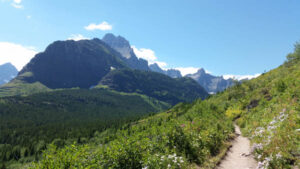 In 1910, Congress established Glacier National Park in Montana. Conservationist George Bird Grinnell played a key role in the creation of this park in order to preserve the land’s natural beauty. Indians have always revered this region. The Blackfeet,
 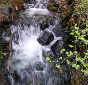 In addition to its glaciers, mountains, and valleys, Glacier National Park covers approximately 1.4 million acres and includes 200 lakes and streams. The park is also home to many different types of wildlife, including black and grizzly bear, moose, golden and bald eagle, bighorn sheep, mountain goat, and whitetail and mule deer.
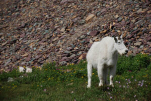 Wild flowers, too, are abundant and put on a lengthy show of color as they follow spring up the mountains all summer long.
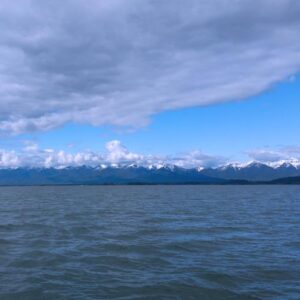
 When to Visit – Most people visit the wilderness between July 1 and October 1. Snow-filled passes and high streams make earlier travel difficult and hazardous. High lakes do not open up until early or mid-June.
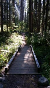 Travel is primarily by foot with some horseback use. Mountain bikes, hang gliders, motorized trail bikes, motorcycles, three and four wheelers, and snowmobiles are not permitted. Few of the trails can be called easy. Some are especially difficult because of steepness. You should be an experienced hiker to travel cross country and should possess map reading and compass skills.
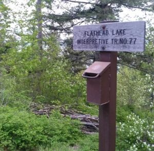 All manner of water sports are enjoyed upon its 200 square miles of surface.
 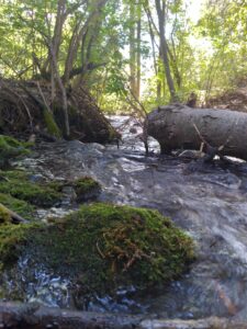 The
The  The trail guide is focused on trails, camping and being in the woods. Mike’s