Hiking in Montana
First of all, BRING BEAR SPRAY. There are limitless hiking, and there are black and grizzly bears in Northwest Montana. Be Bear Aware, and have fun. Hiking is a great way to explore the Montana while experiencing nature and wildlife. Each trail offers an adventure into the vast openness of Montana. From scenic day hikes in Glacier National Park to multi-day wilderness excursions in the Bob Marshall Wilderness, there is something for everyone to enjoy.

If you are near Bigfork, Wayfares State Park is a good place to stop and camp. Not worry,, if you are on the opposite side of the Lake, in Lakeside the trails are all but endless. Blacktail Mountain Ski Resort, just outside of Lakeside is the best hiking opportunity. The south side of Flathead Lake, near Polson provides limited hiking. If you continue to travel south into the Mission Valley hiking trails are available for you to enjoy.
In addition to hiking trails, there are ample campgrounds, both public and private around the Flathead Lake.
Some Hikes to Enjoy around Flathead Lake Include:
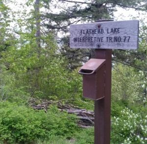
- Flathead Lake Trail: The trailhead for this easy trail is around Highway 35.
- Jewel Basin Hiking Area: The Jewel Basin area is accessible from the Bigfork area.
- Pablo National Wildlife Refuge: The Pablo National Wildlife Refuge is south of Polson and Flathead Lake.


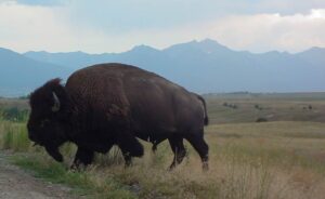 A large portion of the 18, 500 acre Range consists of native Palouse prairie; forests, wetlands, and streams are also found here providing a wide range of habitats for wildlife. Elk, deer, pronghorn, black bear, coyote and ground squirrels are just some of the mammals that share the area with 350 to 500 bison. Over 200 species of birds also call this home including eagles, hawks, meadowlarks, bluebirds, ducks, and geese.
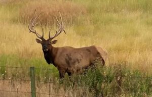 Prairie Drive/West Loop: a 5-mile gravel road that travels through the flats. It is open to trailers and large RVs. It goes by the Bison Display Pasture. Plan for 1/2 hour. Open year round.